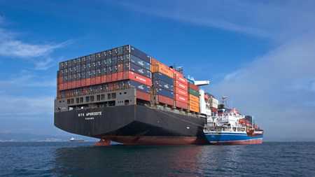
Researchers from Michigan State University (MSU), the University of Waterloo and the University of Alaska Fairbanks report on ships as they navigate the ice-covered Arctic waters between Alaska and Russia, and what those reports could mean for important wildlife and communities.
In the area. “Even with climate change, sea ice remains a significant barrier to Arctic shipping,” said Kelly Kapsar, a researcher with MSU’s Center for Systems Integration and Sustainable Development (CSIS).
“Sea ice also provides critical habitat for many endemic Arctic species and hunting grounds for native subsistence hunters. Understanding when and where ships enter sea ice areas will help us better understand the potential impacts of ship traffic in the region.”
Increased sea traffic is a given, whether it’s fishing vessels looking for better catches during a longer season or Russian shipping companies looking for better ways to deliver oil and gas to Chinese customers. Is this traffic only during the open water season or also during the ice cover?
But scientists point out the differences between what ships can do as the ice changes and what they do can be very different. “Until now, the predictions were about theoretical ships, for example, it was found that some types of ships can pass through up to 2 meters of ice,” said Kapsar.
“But that’s like saying a car can go up to 200 miles an hour – that doesn’t mean it will.”
By combining satellite images of the ice sheet with GPS ship tracking data, the team was able to analyze how ships behaved as shipping lanes changed. They discovered that many ships follow the ice and fish near the edges of the ice packs.
The researchers also found significant overlap between the wintering areas of ships traveling on sea ice and whales.
Previous research by another group showed that between 1990 and 2012, about 12 percent of whales caught by Alaskan Native subsistence hunters showed signs of involvement in fishing, and 2 percent had scars from ship collisions.
The new analysis shows a growing threat to wildlife, which also use the receding ice to travel and breed. The noise from large boats can also disturb marine mammals. Ships equipped for icebreaking can encounter animals and people moving on the ice. Increased traffic also increases the fear of accidents and oil spills. The new roads are far from rescue or cleanup personnel.
Kapsar said their work to date shows that cruise travel reflects a degree of caution, suggesting that capacity is balanced against practical and economic realities.