Most infrastructure decisions today still rely on static maps, periodic surveys, and fragmented datasets. Whether it is flood planning, urban expansion, or reservoir management, the underlying data is often outdated by the time it is used.
EarthSense Labs is building a system that tries to change this by creating a continuously updated, simulation-ready model of the physical world.
Founded out of the Indian Institute of Technology Delhi ecosystem, EarthSense Labs is a geospatial AI startup focused on turning large-scale earth data into usable intelligence.
The company is incubated at IIT Delhi’s Research and Innovation Park and has received early institutional backing, including support from the IndiaAI Mission.
The founding team comes from a mix of academic research and applied engineering. The company positions itself clearly as a research-driven venture translating academic work in geospatial science and physics-based modelling into deployable systems.
From the beginning, the company’s focus has been on one core idea: instead of looking at maps as static layers, treat the earth as a dynamic system where terrain, water, infrastructure, and climate interact continuously.
The Product: GeoTwin 4D
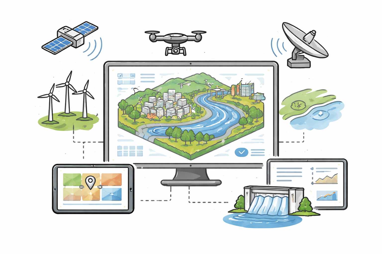
At the centre of EarthSense Labs’ offering is a platform called GeoTwin 4D. The simplest way to understand it is as a digital twin of the physical environment.
A digital twin is a virtual model of a real-world system that updates as conditions change. In this case, the system being modelled is not a factory or a machine, but entire landscapes—cities, river basins, dams, and infrastructure networks.
GeoTwin 4D is built using large-scale geospatial datasets, including LiDAR scans, satellite imagery, terrain models, and infrastructure data. These datasets are processed and layered to create a high-resolution representation of the physical world.
What makes the system different from traditional GIS tools is that it is not just for visualisation. It is designed for simulation.
Instead of just showing what exists, the platform can model what might happen.
How it works
The system operates in three layers.
The first layer is data ingestion. EarthSense pulls in multiple sources of geospatial data—topography, land use, hydrology, built infrastructure, and environmental signals. This data is standardised and aligned into a common spatial framework.
The second layer is modelling. This is where physics-based models come in. For example, if the use case is flood prediction, the system models how water flows across terrain based on elevation, soil type, rainfall patterns, and existing drainage infrastructure.
This is important because it moves beyond pattern recognition. Instead of only learning from past data, the system uses the laws of physics to simulate outcomes. That makes it more reliable in scenarios where historical data is limited or changing conditions create new patterns.
The third layer is AI-driven interpretation. Machine learning models are used to refine predictions, identify patterns, and generate insights. These models help translate complex simulation outputs into actionable information.
For example, instead of showing a complex hydrological model, the system can highlight specific areas at risk, estimate impact levels, and suggest intervention points.
The “4D” in GeoTwin refers to time. The system is designed to update continuously, allowing users to see how conditions evolve rather than working with static snapshots.
Use Cases
EarthSense Labs is focusing on sectors where decisions depend heavily on spatial and environmental data.
One of the primary use cases is flood modelling. Authorities can simulate how water will move during heavy rainfall events and identify vulnerable zones. This is particularly relevant in urban areas where drainage systems interact with natural terrain in complex ways.
Another area is water resource management. Reservoirs and dams require careful monitoring of inflows, storage levels, and downstream impact. A dynamic model helps operators plan releases and manage risk more effectively.
The platform is also used in city management. Urban planners can evaluate how infrastructure projects—roads, buildings, drainage systems—will interact with the environment over time.
What makes these use cases practical is that the system operates at an “asset level.” Instead of broad regional insights, it can provide information tied to specific roads, buildings, or infrastructure components.
Deployments
EarthSense Labs is still in its early phase, but it has already moved beyond pure research.
The company has delivered projects across domains like flood modelling and city-scale simulations, working with institutional and government stakeholders.
It has also been showcased at events such as India Mobile Congress 2025, indicating early visibility within the policy and technology ecosystem.
Since the company is relatively young, large-scale public deployments are still emerging. However, the focus so far has been on demonstrating that high-resolution, real-time digital twins can be built and used in operational contexts.
Funding
Unlike venture-backed startups that raise large private rounds early, EarthSense Labs has followed a more research-driven funding path.
It has received incubation support and grants through IIT Delhi’s Foundation for Innovation and Technology Transfer (FITT), along with backing from the IndiaAI Mission.
This type of funding is typical for deep-tech companies working on foundational systems, where early development requires significant research before commercial scaling.
Market Feedback
Early feedback tends to focus on usability and integration.
For organisations used to static GIS tools, moving to a dynamic simulation system requires changes in workflow. Decision-makers need to trust model outputs and understand how to interpret them.
There is also the challenge of data quality. The system depends heavily on accurate and up-to-date geospatial data. In regions where data is incomplete or inconsistent, the models require additional calibration.
At the same time, the value becomes clear in high-stakes scenarios. When planning flood mitigation or infrastructure investments, the ability to simulate outcomes before implementation is a significant advantage.
Competition
EarthSense Labs operates in the broader category of geospatial intelligence and digital twin platforms.
Global players like Descartes Labs and Planet Labs focus on large-scale earth observation and analytics, often using satellite data as the primary input.
Companies like Bentley Systems and Esri provide tools for mapping and infrastructure modelling, widely used by governments and enterprises.
What differentiates EarthSense Labs is its attempt to combine physics-based simulation with AI in a single system, and to make it operate in near real time. Instead of being just a mapping tool or a data provider, it positions itself as a decision-support system.
Global Context
Globally, there is growing interest in digital twins for infrastructure and environmental systems.
Cities are increasingly looking to simulate traffic, energy use, and environmental risks before implementing policies. Climate change has added urgency to this, as extreme events like floods and heatwaves require better predictive tools.
Advances in computing, sensor networks, and satellite data have made it possible to build these systems at larger scales. What was once limited to industrial applications is now being extended to entire cities and regions.
However, most implementations are still fragmented. Data sits in different systems, models are built for specific use cases, and integration remains a challenge.
This is where platforms like GeoTwin aim to play a role—by bringing multiple data streams and models into a unified system.
- Our correspondent