There is a quiet shift happening in how we understand the world. Satellites orbit the Earth, capturing images every day—of farms, rivers, cities, and forests. For decades, this data existed, but it was mostly used by governments or scientists.
SatSure starts with a different question: what if this data could be used by banks, farmers, insurers, and city planners—every day, in real decisions?
This is the story of a company trying to make “space data” usable on the ground.
The origin:
SatSure was founded in 2017 by Prateep Basu, Rashmit Singh Sukhmani, and Abhishek Raju. The founding team included people with experience in space technology and data systems, including backgrounds linked to the Indian space ecosystem.
The original idea was not to build satellites, but to solve a different problem. Satellite images already existed. The real challenge was that most organisations did not know how to use them.
A farmer cannot read satellite imagery. A banker cannot interpret vegetation indices. A government official cannot manually analyse thousands of images.
SatSure’s starting point was this gap: there is a lot of data → but very little usable insight.
What SatSure does
At its core, SatSure converts satellite data into decision tools. Think of it as a translation layer. Satellites capture raw images. These images are just pixels. By themselves, they do not answer questions like: Is this crop healthy?
Is this land flooded? Is this infrastructure project progressing?
SatSure combines satellite imagery with other data—weather, soil, IoT sensors, financial data—and runs it through machine learning models.
The output is not an image. It is a decision. For example: A bank gets a “risk score” for a farm loan. An insurer gets an estimate of crop damage. Government gets alerts on drought or flood risk. This is what the company calls “decision intelligence.”
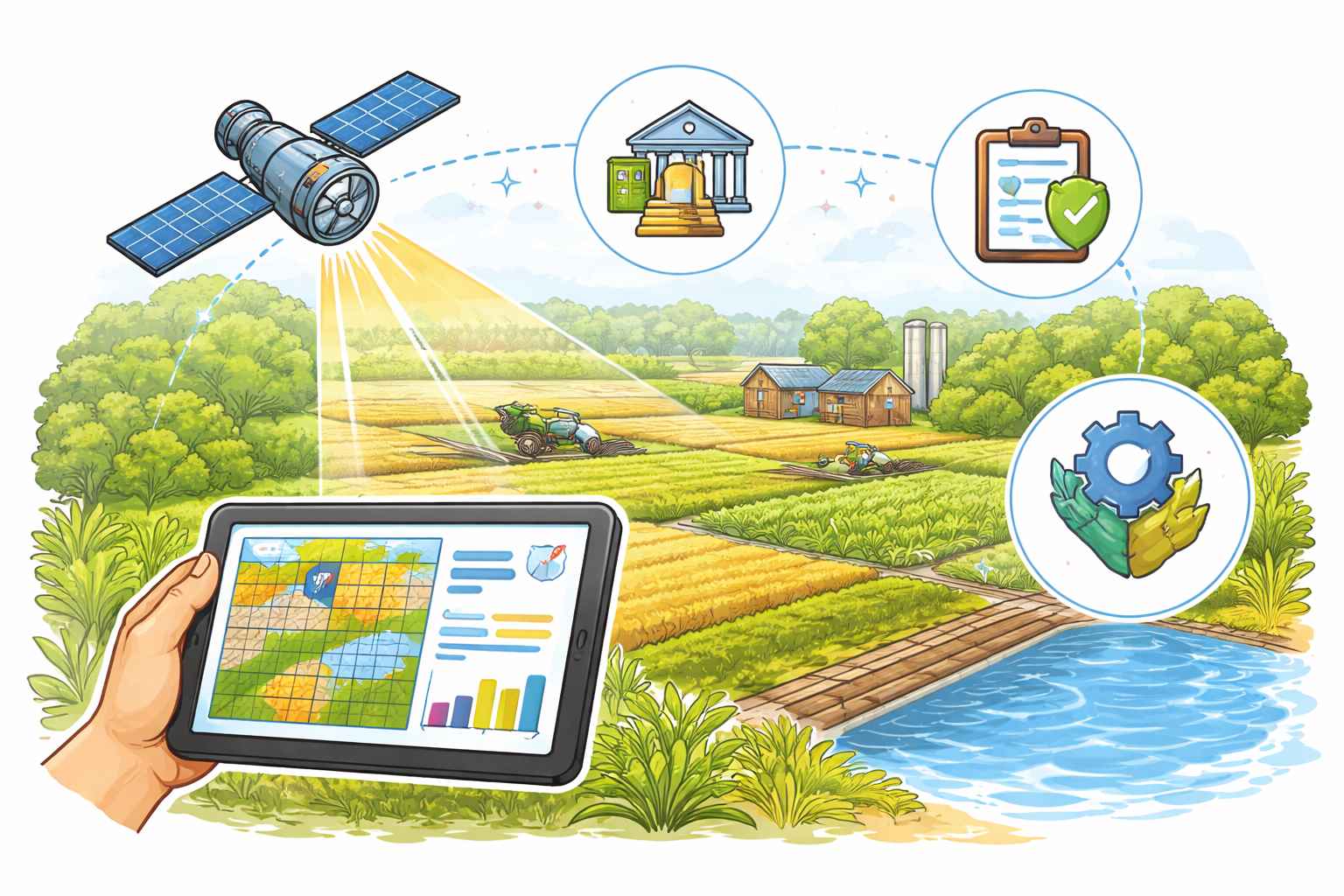
How the system works
The system has three layers. First is data collection. This includes satellite images, drone imagery, weather data, and ground inputs.
Second is processing. Algorithms analyse patterns—such as vegetation health, water levels, or land use changes.
Third is delivery. Insights are delivered through dashboards, APIs, or reports that clients can directly use.
So instead of looking at a satellite image, a user sees something like: “Crop stress detected in this region” “Flood risk rising in this district” “Loan risk level: medium” That simplification is the product.
Where it is used
SatSure operates across multiple sectors, but the core logic is the same: large-area monitoring where physical inspection is difficult. In agriculture, it helps monitor crop health, estimate yields, and assess risks. This is useful for both farmers and financial institutions.
In banking and financial services, it helps lenders evaluate agricultural loans. Instead of relying only on paperwork, they can use satellite data to verify crop conditions. In insurance, it helps assess damage after events like floods or droughts, reducing the need for manual surveys.
In infrastructure, it tracks project progress—roads, pipelines, or construction—using change detection over time.
Across all these use cases, the common thread is scale. These are problems that cover thousands of hectares or entire regions.
Scale and traction
SatSure operates globally, with presence in India, the US, and other regions.
Its platform processes large volumes of data—over 10 terabytes of Earth data daily—and analyses tens of millions of hectares annually. It has impacted more than 2 million farmers and monitors hundreds of thousands of villages regularly.
These numbers matter because they show something important: the model works at scale.
Funding and growth
SatSure has raised over $20 million in funding across multiple rounds.
A key milestone was its $15 million Series A round led by Baring Private Equity Partners and Promus Ventures, with participation from Omidyar Network India and others.
The funding has been used to expand globally and to build its own satellite capabilities, including plans for a dedicated satellite fleet.
What makes it unique
There are many companies working with satellite data. SatSure’s difference lies in how it packages the output.
First, it focuses on decisions, not data. Most satellite companies provide imagery or analytics. SatSure provides outcomes—scores, alerts, and recommendations.
Second, it integrates multiple data sources. Satellite data alone is not enough. By combining it with weather, financial, and ground data, the system becomes more accurate.
Third, it is built for non-experts. The end user does not need to understand geospatial science.
Fourth, it operates across sectors. The same core engine can be applied to agriculture, finance, infrastructure, and climate.
Real-world performance and feedback
One of the most practical validations of SatSure’s model comes from the financial sector. Banks and NBFCs use its data to improve agricultural lending decisions. This reduces default risk and improves credit access for farmers who might otherwise be excluded.
In agriculture, the company has demonstrated strong correlation between satellite-derived crop data and actual ground conditions.
This is critical. If satellite insights do not match reality, the system fails. The fact that they align is what enables adoption.
Feedback from the market typically focuses on two things.
First, efficiency. Large-scale monitoring becomes faster and cheaper compared to manual surveys.
Second, confidence. Decision-makers have an additional layer of data to support their choices.
The global context
SatSure operates in a broader field called Earth observation analytics. Globally, this space is evolving quickly. Satellites are becoming cheaper to launch, and data availability is increasing. The bottleneck is shifting from data collection to data usage.
Historically, the biggest users of satellite data were governments and defence agencies. Today, private sector use is growing—especially in agriculture, finance, and climate monitoring. Companies around the world are building platforms to analyse this data. But many still focus on providing tools rather than end-to-end solutions.
SatSure’s positioning is closer to a full-stack system—from data to decision.
- Our correspondent